Jet stream wobble keeps Arctic air in the forecast next week
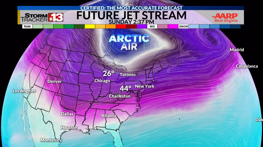
WOWK — One of the biggest clues on what’s to come for our forecast is watching our jet stream. This time of year, cold arctic air clashes with warmer air along the southern Gulf creating a wave like pattern. For us, we’ll see temperatures rise and fall as these two air masses try to find an equal balance. So, enjoy a week of wild swings mixed with windy, snowy, rainy days.
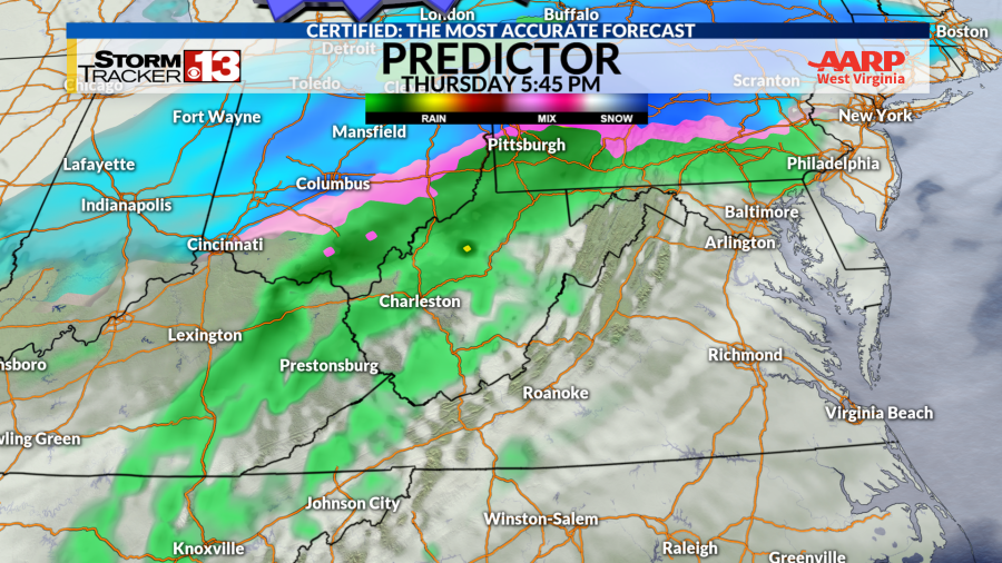
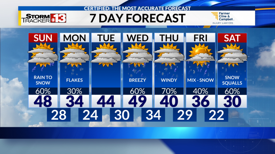
Sunday:
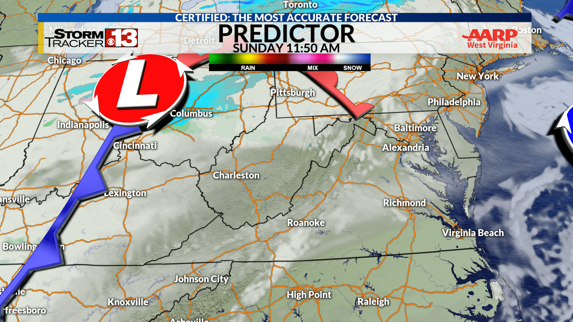
A warm front crossing in the morning hours brings a few scattered rain showers and helps push the cold arctic air farther north. Temperatures will start cold in the 20s then rise into the mid and upper 40s for the afternoon. Into the late evening, a cold front crosses switching winds from the northwest ushering in colder air. Some refreezing roads is possible as ground temperatures cool. Overnight lows dip into the 20s.
Monday:
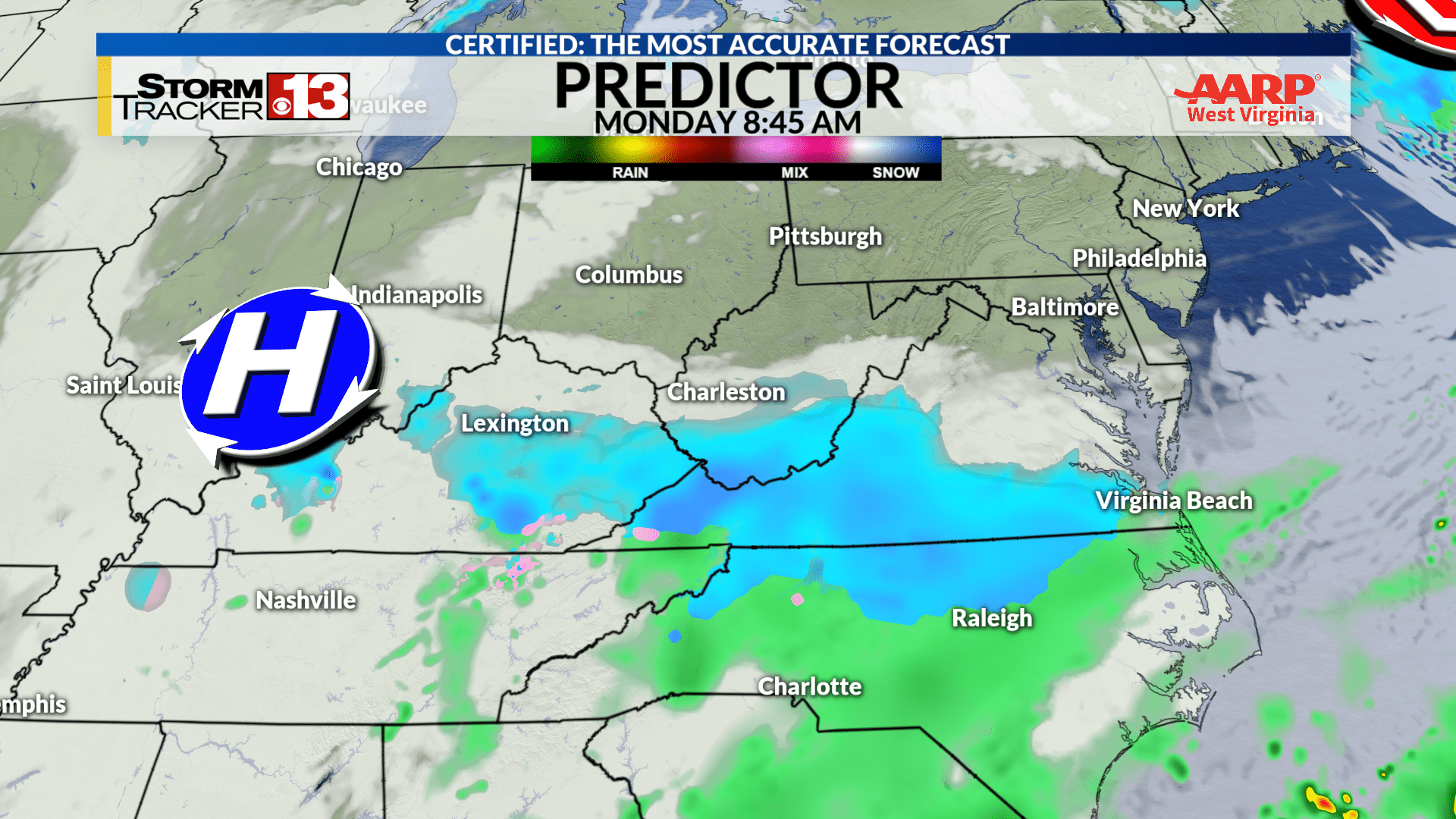
With colder air pushing farther south, highs for Monday struggle to reach the mid 30s for many. Southern moisture drifts north creating another morning commute with snow showers for the southern coalfields. Much like Friday saw, snow totals won’t be impressive but the timing is less than ideal as snow will stick with below freezing road temperatures. The system scoots east following the jet stream by the middle of the day, but icy and snowy roads south of Charleston are again likely. Flurries will be likely into the night with wet roads of the day refreezing at night with lows in the teens.
Tuesday & Wednesday
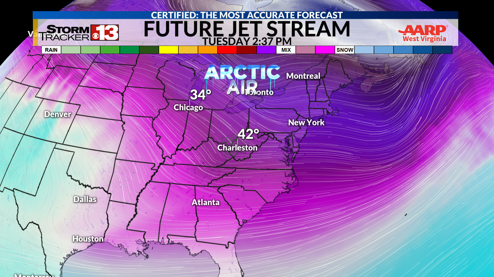
A tad of a warm-up from Monday will be slow but help push Tuesday into the mid 40s with the 50 degree mark by Wednesday afternoon. It’ll be a short warmup as a cold front Wednesday kicks up the winds from the northwest. A rainy Wednesday will end with snow showers and windy conditions. Those with inflatable holiday decorations may want to secure them over the two day temperature swing.
Thursday into Friday
Another warm front swings in as our jet stream nudges north allowing temps to rebound after a cold morning into the low 40s. Showers are likely during this time but a cold front Thursday night into Friday brings back the colder air. Friday, northwest winds take over with a vengeance helping drop temperatures quickly. Low temperatures and even lower wind chill values as passing snow flurries and showers cross the region.
Saturday:
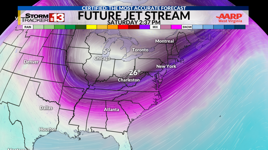
Indication are following the cold front from Thursday/Friday, cold air dives deep into the southern U.S. Highs for the day will be stuck in the upper 20s and low 30s making even the lightest winds sting the face. Snow showers from the Great Lakes with some snow squalls in this set up are possible. It’ll certainly be a day to watch as we get closer to see if warmer southern air can help mitigate the arctic blast long range models are showing are possible.
Either way, our up-coming week will be a windy and messy one as the war of cold vs. warm rages on. It’ll be a good week to watch the winds for outdoor decorations, plan on some travel delays with morning systems, and keep the jackets and umbrellas on standby.
We make it easy to stay ahead of the storms with the Stormtracker 13 app, TV broadcast, and streaming platform – WOWK+ available on Apple TV, Amazon Fire Stick, and Roku TVs.
Copyright 2025 Nexstar Media, Inc. All rights reserved. This material may not be published, broadcast, rewritten, or redistributed.
For the latest news, weather, sports, and streaming video, head to WOWK 13 News.


Leave a Reply