Red Flag Alert: Low Humidity and Gusty Winds; Cool Front Brings More Wind Today | 3/22 AM
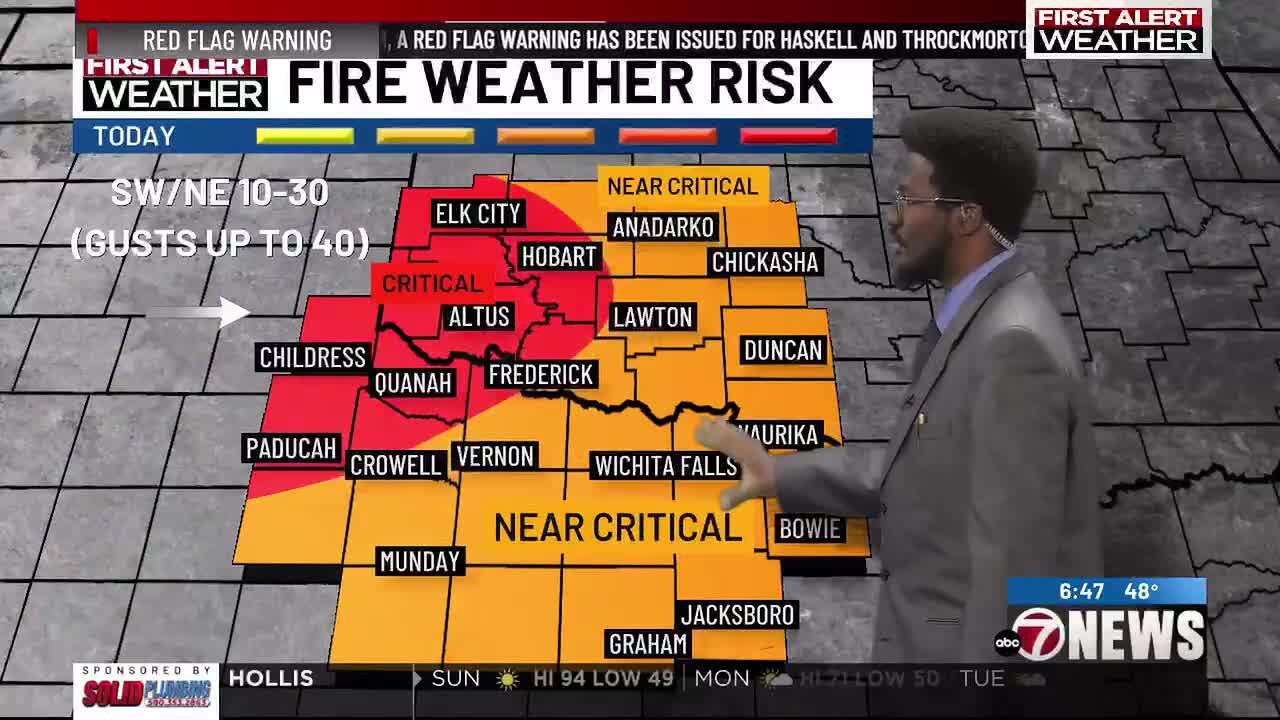
Lawton, Okla. – A cool front is expected to move through the area later this afternoon and evening. Ahead of the front, southwest winds are currently sustained between 5 to 20 mph, with gusts reaching up to 25 mph early today. This weather pattern is leading to a critical fire risk in the western and northwestern counties. For other regions, a near-critical fire risk is anticipated.
After the front passes, stronger north and northeast winds are expected, with sustained speeds ranging from 10 to 30 mph and gusts as high as 40 mph. Due to these conditions, Red Flag Warnings are in effect for most parts of the area and will remain active until 8 p.m. or 9 p.m., depending on the specific county.
Today’s weather will feature mostly sunny skies, with high temperatures ranging from the low 80s in the northern areas to near 100 degrees in the southern regions. This variation is due to the timing of the front moving through. As the night progresses, clouds will begin to increase, and overnight lows are expected to be in the upper 40s to low 50s.
Moving into Monday, temperatures will gradually rise, with highs in the upper 60s to low 70s. This is a temporary break before a ridge of high pressure begins to take control again. By the middle of the week, temperatures are expected to rise once more, bringing back the warmer conditions that were previously experienced.
Meteorologist Michael Amankwaa


Leave a Reply