How Hot Will Houston Stay? Here’s the Forecast.
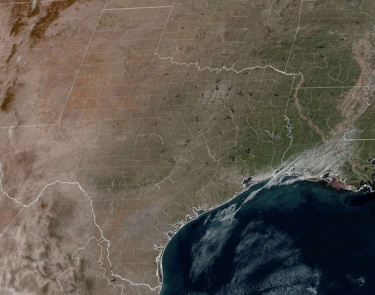
March has been an unusually warm month across Southeast Texas, with Houston experiencing some of the highest temperatures in over a century. The city’s average high temperature this month has reached 79.2 degrees, marking it as the warmest start to March since 1908. This trend has continued for most of the month, with 15 out of the 21 days so far seeing temperatures of 80 degrees or higher—far above what is typical for this time of year.
According to climate norms, high temperatures should be in the mid-70s by late March. However, the current weather pattern shows no signs of cooling down soon. A ridge of high pressure is expected to remain over the area through Sunday and into the upcoming week, leading to continued above-average temperatures. While long-range models suggest some changes may occur by next weekend, the immediate forecast remains focused on warmth and dry conditions.
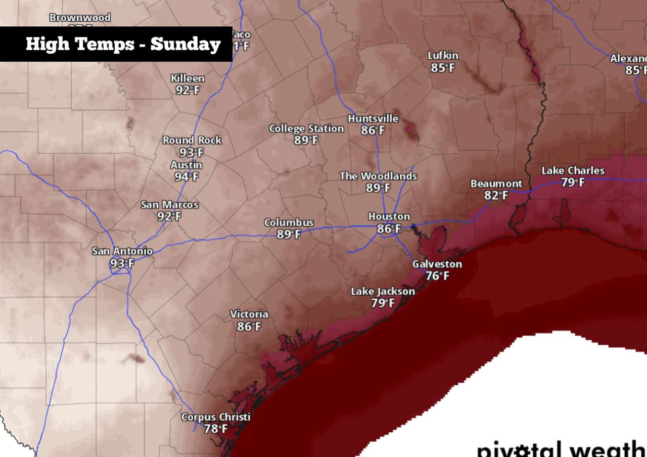
Sunday’s Forecast
Early morning conditions in the Houston area will be pleasant but humid. Temperatures are expected to hover in the mid-60s until around 8 a.m., with the possibility of patchy fog spreading across the region. This fog should begin to dissipate by late morning, giving way to mostly sunny skies.
As the day progresses, temperatures will rise steadily. By 10 a.m., highs will reach the low 70s, and by early afternoon, they will climb into the 80s. Afternoon high temperatures are projected to hit between 85 and 87 degrees, just shy of the daily record of 89 degrees set in 1916. South winds will be breezy, ranging from 10 to 15 mph, with occasional gusts exceeding 20 mph.
Staying Warm This Week
A weak cold front is expected to move into parts of Central Texas early Monday morning. However, this front is likely to stall before reaching the Houston area, keeping cooler air confined to the north. While the Dallas-Fort Worth area could see temperatures drop by 10 to 15 degrees on Monday, Houston will remain in the mid- to upper 80s.
High pressure will continue to build over Texas throughout the middle of the week, maintaining temperatures well above normal. From Tuesday through Friday, Houston can expect consistent weather, with high temperatures ranging between 85 and 87 degrees each day. Overnight lows will also stay above average, hovering in the mid-60s.
The week will also be very dry, with little chance of rain across the Houston metro area. While isolated showers cannot be ruled out near the coast, overall precipitation chances will remain below 10%.
Long-Term Outlook
Looking ahead to next weekend and into the first week of April, long-range weather models suggest that above-average temperatures will persist, with highs expected to remain in the 80s. However, there is still some uncertainty in the forecast at this point.
The American GFS weather model, for example, indicates the potential for a cold front to move through Texas by March 28-29. If this occurs, it could briefly lower temperatures back into the 70s and increase the chances of rain slightly. However, any cooler air brought in by the front is unlikely to last for long.
The Climate Prediction Center’s April outlook supports the idea that above-average temperatures are likely across all of Texas. As the weather pattern evolves, residents should stay tuned for updates and adjust their plans accordingly.

- How Hot Will Houston Stay? Here’s the Forecast. - March 29, 2026
- Pusat LGBTQ Las Vegas membuka pusat kesehatan baru - March 29, 2026
- Pembayaran SPP Gratis Setiap 6 Bulan Didemo - March 29, 2026


Leave a Reply