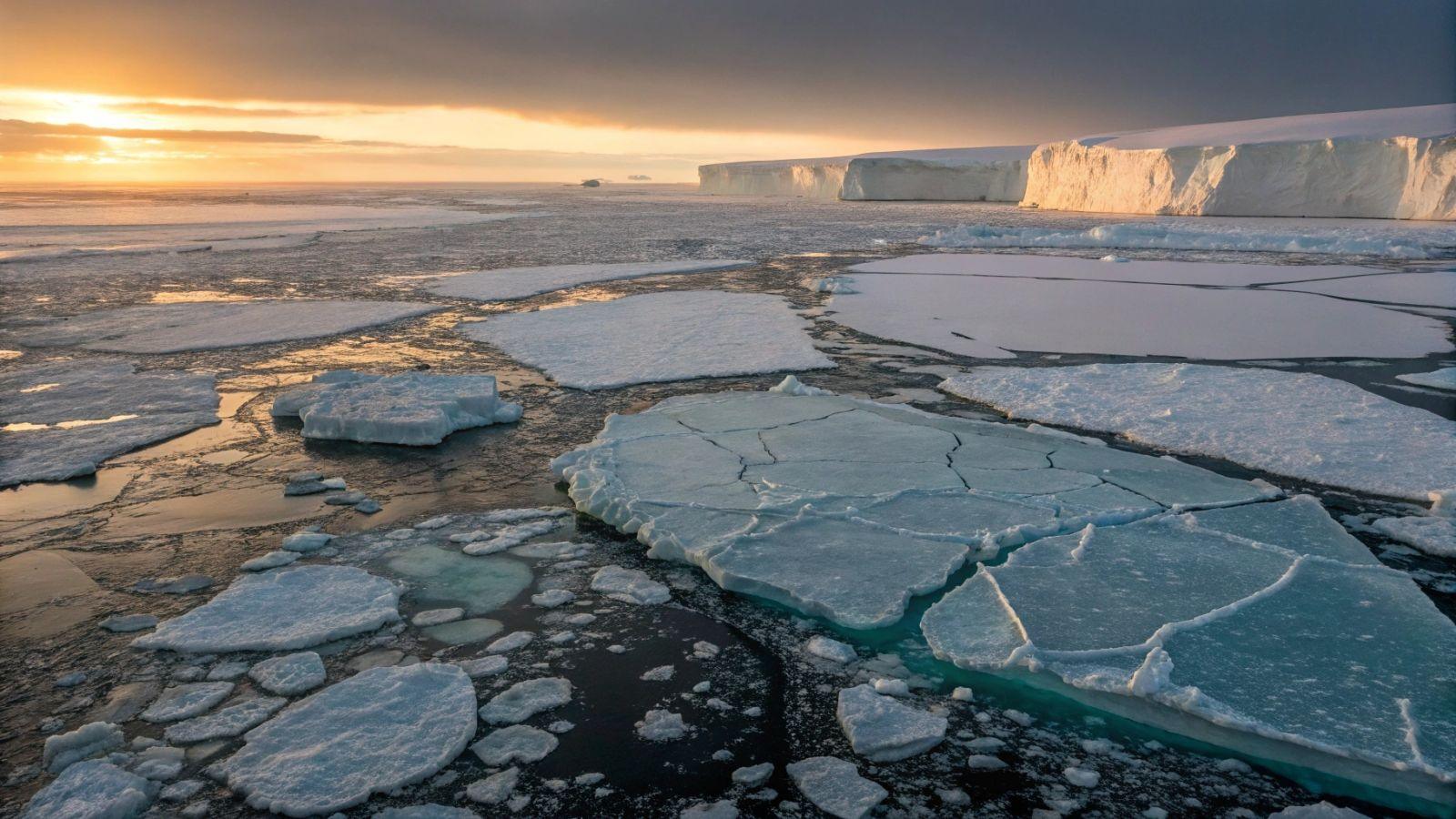
Antarctica Loses 5,000 Square Miles of Anchored Ice
Understanding the Stability and Retreat of Antarctica’s Coastline
A comprehensive study spanning three decades has revealed a complex picture of Antarctica’s coastline. While the majority of the continent’s coast remains relatively stable, certain regions are experiencing significant ice retreat. This apparent contradiction raises important questions about how such stability coexists with substantial ice loss.
To address this, glaciologists have analyzed satellite data from multiple space missions, including those from the European Space Agency and commercial satellites. This effort has led to the creation of the first continent-wide map of grounding line movement, which marks the point where Antarctic ice transitions from being anchored to the land to floating on the ocean.
The findings, published in a recent scientific journal, show that 77% of the Antarctic coastline has remained stable since 1996. However, in the western part of the continent, particularly along the Antarctic Peninsula and some areas in the east, there has been notable ice retreat. In total, nearly 5,000 square miles (13,000 square kilometers) of anchored ice have disappeared over this period.
The most dramatic retreats have occurred in the Amundsen Sea and Getz regions. For instance, Pine Island Glacier has retreated by 20 miles (33 kilometers), while Thwaites Glacier has moved back by 16 miles (26 kilometers). Scientists generally attribute these changes to warm ocean water seeping beneath the ice shelves, causing them to thin from below.
However, a puzzling situation exists in the northeast of the Antarctic Peninsula. Glaciers such as Edgeworth and Hektoria have retreated several kilometers, yet no evidence of warm water has been confirmed in these areas. Researchers acknowledge that other factors must be influencing these glaciers, but they have not yet identified what those factors might be.
This detailed map of grounding line movements serves as a critical reference for predicting future sea level rise. Modeling teams must be able to replicate these observations to validate their projections. If they cannot, it may indicate that their assumptions need to be reevaluated.
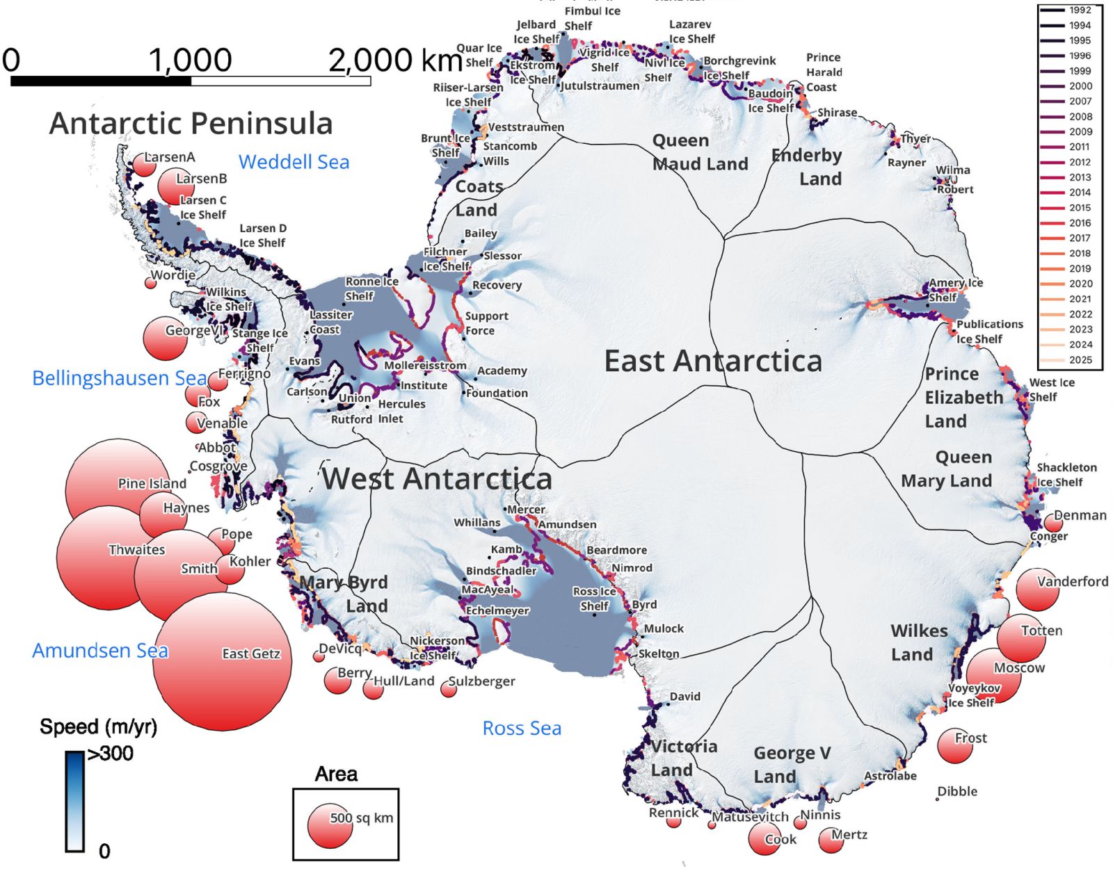
Evolution of the Antarctic Grounding Line
The evolution of the Antarctic grounding line between 1992 and 2025 is depicted in a color-coded map. The colors range from black (representing 1992) to red and white (representing 2025). This map is overlaid on a glacier speed map, which shows the movement of glaciers from white (fast) to blue (slow), and on a 2011 relief map of Antarctica.
Circles on the map indicate areas where the grounding line retreated between 1996 and 2025 for 31 different regions. The color of each circle ranges from red to white depending on the extent of the retreat. A reference circle illustrates a retreat of 190 square miles (500 square kilometers).
What is the Grounding Line?
The grounding line is the boundary where Antarctica’s continental ice begins to float on the ocean. It marks the transition between ice that is anchored to the ground and the floating ice shelves. The position of the grounding line is a crucial indicator of glacier stability.
When the grounding line retreats, it means the ice is losing its anchor, making the glacier more vulnerable. This retreat can lead to an acceleration of ice flow into the ocean, contributing to rising sea levels.
Scientists measure the grounding line using satellite radars, which can penetrate clouds and polar darkness. These instruments detect subtle movements of the ice over long periods, enabling precise mapping of changes.
Additional Topics
- 🌊 Iceberg melting is not at all producing what was expected
- 💪 The best physical exercise for seniors is not what you think
- ❄️ Ice Memory: a sanctuary of ice for the centuries to come
- ❄️ This iceberg drifting for 40 years suddenly changes color: why?

- Mengenal XERF: Perawatan Kencangkan Kulit Efektif - March 28, 2026
- Antarctica Loses 5,000 Square Miles of Anchored Ice - March 28, 2026
- Selain Tidak Terdaftar BPOM, Apa Ciri Skincare Abal-abal Dr. Joice? - March 28, 2026


Leave a Reply