Winter Storm Warning: 10 Inches of Snow Looms, Dangerous Driving Ahead
Unseasonal Winter Storm Hits Northern New England
A powerful winter storm is set to impact northern New England just one day after the official start of spring, bringing with it a mix of heavy snowfall and hazardous travel conditions. Forecasters are urging residents to prepare for severe weather that could disrupt daily life and make roads treacherous.
Areas Under Winter Storm Warning
A Winter Storm Warning has been issued for parts of western Maine and northern New Hampshire, including key locations such as Fryeburg, Bethel, Rangeley, Farmington, Conway, and Wolfeboro. The warning is in effect from 2 a.m. on Sunday through 2 a.m. on Monday. During this time, the region can expect significant snowfall, with total accumulations ranging between six and ten inches.
The storm is expected to begin early on Sunday morning and continue throughout the day before gradually tapering off overnight into Monday. Snowfall rates will be highest between 1 a.m. and 10 a.m. on Sunday, with plowable snow expected throughout the duration of the storm.
“Travel might be impacted,” forecasters warned, “Periods of moderate and heavy snow will combine with low visibility to create dangerous driving conditions.”
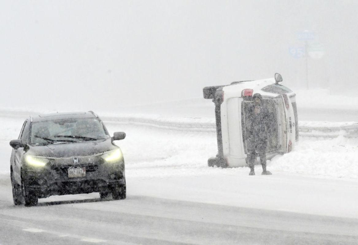
Dangerous Road Conditions Expected
Snow-covered and slippery roads are anticipated across the warning area, prompting officials to urge motorists to avoid unnecessary travel during the peak of the storm. The combination of heavy snow and reduced visibility could lead to challenging driving conditions, especially for those unfamiliar with winter weather.
Additional Advisory for Southern and Central Maine
In addition to the Winter Storm Warning, a Winter Weather Advisory is in effect for much of southern and central Maine, including cities like Portland, Augusta, Lewiston, Brunswick, and Belfast. This advisory runs from 5 a.m. on Sunday through 5 a.m. on Monday, with three to six inches of snow expected in these areas. While the snowfall amounts are lighter than in the warning zone, travel could still be affected due to slick roads and reduced visibility.
Temperature Drop Following the Storm
After the storm passes, temperatures are expected to drop significantly. Much colder air is anticipated to sweep southward across the Northeast from Sunday into Monday, adding to the challenges faced by residents in the region.
Preparing for the Storm
Residents in the affected areas are encouraged to stay informed about the latest weather updates and take necessary precautions. It is advisable to stock up on essential supplies, ensure vehicles are equipped for winter conditions, and avoid traveling unless absolutely necessary.
As the unseasonal storm moves through the region, it serves as a reminder of the unpredictable nature of weather patterns, even during the transition into spring. Staying prepared and aware is crucial for ensuring safety and minimizing disruptions during such events.

- Sekolah Swasta Gratis Siap Beroperasi di Jakarta 2026 - March 27, 2026
- Winter Storm Warning: 10 Inches of Snow Looms, Dangerous Driving Ahead - March 27, 2026
- 7 aktivitas sederhana tingkatkan logika dan numerasi anak - March 27, 2026


Leave a Reply