Maps reveal California’s greatest sinking areas over the past decade
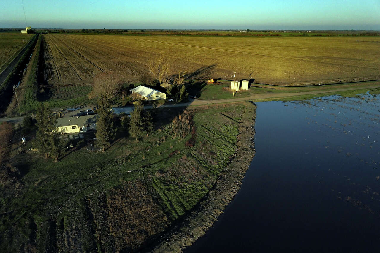
Over the past decade, parts of California have experienced significant sinking, according to satellite measurements. The San Joaquin Valley has been particularly affected, with certain areas in the Tulare Basin dropping by more than seven feet between 2015 and 2025. While the most severe declines occurred during dry years, subsidence did not cease when wetter conditions returned. In fact, from 2024 to 2025, some sections of the basin sank by as much as five inches.
In addition to the San Joaquin Valley, parts of the San Francisco Bay Area have also seen land subsidence, though to a lesser extent. For instance, areas in the North Bay and along the bay shoreline have descended several inches over recent years. A map illustrating these changes from June 2015 to October 2025, based on data from the Department of Water Resources, highlights the areas that have sunk or risen. However, this data does not cover the entire state, as it is focused on groundwater basins. There are also regions where reliable year-to-year measurements were not possible due to changes in land use.
The map below shows how California’s landscape changed from 2015 to 2025, based on data from the Department of Water Resources. Areas colored in teal indicate sinking, while those in orange show rising. Regions in light yellow experienced little to no change.
The map data comes from measurements taken by the European Space Agency’s Sentinel-1 satellites. These satellites use radar pulses to create detailed images of the Earth’s surface. By comparing repeated satellite passes, experts can determine where the ground has risen or fallen over time.
Several factors contribute to vertical land motion, but in California, subsidence has largely been caused by agricultural pumping for groundwater. During droughts, farmers rely on groundwater to grow crops when surface water supplies are insufficient. This water is drawn from deep underground aquifers, which are porous rock layers. Over-pumping has led to the collapse of these aquifers, causing the ground to sink. In clay layers, this change can be irreversible, similar to squeezing water out of a sponge and finding it doesn’t bounce back.
Over the past century, subsidence has had significant impacts on California’s infrastructure, including bridges, levees, and water conveyance systems. Further subsidence, combined with more severe droughts due to climate change, could lead to an 87% reduction in State Water Project deliveries by 2043, according to a Department of Water Resources report.
“When you start to disrupt the land surface, you’re going to cause a lot of damage,” said Paul Gosselin, deputy director for sustainable water management at the California Department of Water Resources.
Changes in the Bay Area, although less dramatic than those in the Tulare Basin, could still have major consequences. Scientists have previously reported that San Francisco International Airport is sinking, increasing its exposure to coastal flooding.
In the Bay Area, subsidence is primarily due to the compaction of sediments and artificial fill, especially in areas like Treasure Island and Foster City. These locations may face increased flood risks as sea levels rise.
“Some places are in much bigger trouble much faster than others,” said Stefan Talke, a professor of civil and environmental engineering at California Polytechnic State University at San Luis Obispo.
Other areas in California have experienced slight uplift over the past ten years, a process linked to fluid extraction and injection for oil production. Geologic processes can also cause subsidence and uplift. For example, major earthquakes in 2019 resulted in areas northeast of Ridgecrest (Kern County) rising by more than a foot.
The Department of Water Resources map focuses on land changes at groundwater basins, but a 2025 NASA-led study provided additional details on subsidence and uplift across much of the rest of the state. Although more comprehensive, the NASA study’s estimates of subsidence only reflect changes from 2016 to 2023. This map incorporates both satellite data and ground motion data from Global Navigation Satellite System stations.
The second map provides information about areas experiencing uplift due to tectonic activity, such as the Transverse Ranges in Southern California, west of the Central Valley, and near the northern border of the state.
A previous Chronicle story featured high-resolution maps focused on San Francisco and other California cities. These maps come from a study that used specialized techniques to resolve fine details about vertical land movement.
California officials are taking steps to prevent or reduce subsidence. The Sustainable Groundwater Management Act, passed in 2014, requires local agencies to regulate excessive groundwater use and bring balanced levels of pumping and recharge to basins. However, it can take years, even a decade, for these changes to affect subsidence rates, according to Gosselin.
{ “__type”: “devHubFreeformEmbed”, “__id”: “Datawrapper”, “__fallbackImage”: “https://datawrapper.dwcdn.net/6juru/mobile.png”, “__data”: { “datawrapper_id”: “6juru” } }
Related Reading
California’s coastal waters are transforming at a surprising rate. Here’s what the future could look like
Bay Area city adds new, drought-proof source of water
Subscribe
There’s more to San Francisco with the Chronicle. Subscribe today for just 25¢.

- IDI Riau Buka Kesempatan Diskusi Dokter RSUD Tengku Rafian Siak tentang Kesetaraan Gaji - March 30, 2026
- Your Core Routine Is Incomplete Without These Oblique Exercises - March 30, 2026
- Mengapa Lutut Saya Memar Akibat Berlari? - March 30, 2026


Leave a Reply