Greenland’s Big Lie: The Map Distortion You’ve Been Misled By!
Why Greenland Appears Much Larger Than It Actually Is
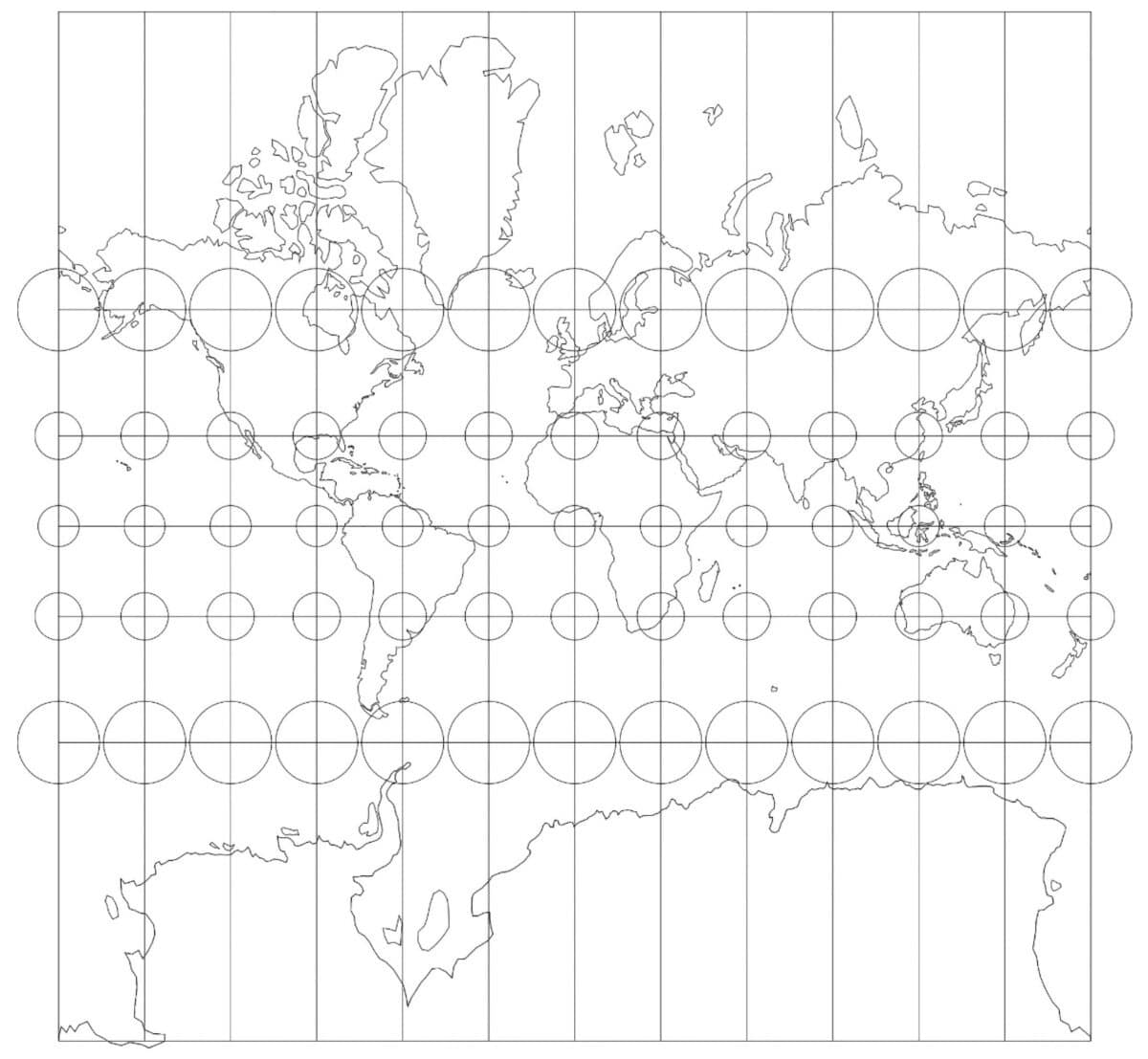
The Mercator projection, a map style developed in 1569, has been widely used for centuries. While it was originally designed to help sailors navigate by preserving angles and straight lines, it comes with a significant drawback: area distortion. This distortion becomes more pronounced as you move toward the poles, which is why landmasses like Greenland appear much larger on most world maps than they actually are.
A recent study led by Lieselot Lapon, a geographer at Ghent University, examined how this distortion affects public perception. Published in the ISPRS International Journal of Geo-Information, the research surveyed over 130,000 participants and found that most people significantly overestimate Greenland’s size. This misperception can influence how we view geography, geopolitics, and even environmental issues related to the Arctic.
The Comparison Between Greenland and Africa
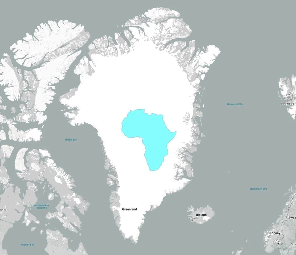
One of the most striking examples of this distortion is the comparison between Greenland and Africa. On many maps using the Mercator projection, the two landmasses appear similar in size. However, in reality, the difference is vast. Greenland covers roughly 836,000 square miles, while Africa spans about 11.7 million square miles, making Africa approximately 14 times larger.
This visual inflation can subtly shape how people perceive the geopolitical weight, natural resources, and environmental relevance of these regions. For instance, the exaggerated size of Greenland may lead to assumptions about its global importance, even though its actual size is much smaller than it appears.
Strategic Importance and Environmental Impact
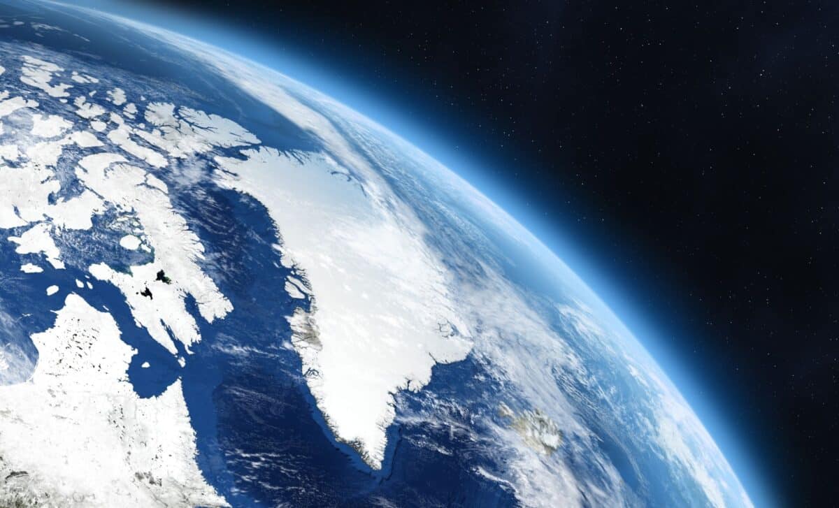
Greenland holds strategic significance due to its location in the Arctic, its mineral resources, and its role in climate change. However, the Mercator projection exaggerates its spatial presence, potentially amplifying assumptions about its global role. This distortion can affect how we understand and discuss the Arctic’s importance in the context of climate change, resource management, and international relations.
How Map Distortions Influence Global Understanding
Map distortions play a critical role in shaping our understanding of global issues. For example, Greenland’s rapidly melting ice sheets contribute significantly to rising sea levels. According to NASA:
“They estimate that Greenland lost 3.8 trillion tonnes of ice between 1992 and 2018 – enough to push global sea level up by 10.6 millimetres. Over the study period, the rate of ice loss was found to have increased seven-fold from 33 billion tonnes per year in the 1990s to 254 billion tonnes per year in the last decade.”
Despite this, online maps such as Google Maps still use a version of the Mercator projection called Web Mercator. This variant is favored for its simplicity in digital mapping, making zooming and scrolling easier. However, it also retains the same distortions, with Greenland still appearing much larger than it actually is. While Google Maps introduced a globe view for desktop users in 2018, the mobile version continues to use the Mercator-style grid, potentially misleading users about Greenland’s true size.
Moving Toward More Accurate Representations
To address these distortions, alternative map projections have been developed. Equal-area projections, for instance, preserve the proportional size of landmasses, although they may distort shapes. The Ghent University study found that people exposed to equal-area maps tend to develop a more accurate understanding of country sizes.
Lieselot Lapon noted: “The results indicate that the accuracy differs with the map projection but not to the extent that one’s global-scale cognitive map is a reflection of a particular map projection.”
No single map projection can perfectly preserve area, shape, distance, and direction all at once. Every map involves some level of compromise. However, recognizing the distortions embedded in widely used projections invites a broader question: how much of what we think we know about the world is shaped by the way it is drawn?
Conclusion
Greenland’s strategic and environmental importance is undeniable. Yet seeing it at its true scale may help ground global conversations about the Arctic in a clearer geographic reality. As we continue to rely on maps for understanding the world, it is essential to be aware of the limitations and biases inherent in different projection styles. By embracing more accurate representations, we can foster a more informed and nuanced perspective of our planet.

- LPDP beri peringatan alumni tidak patuh di website - March 28, 2026
- Yohanes Surya Beri Kuliah Umum untuk Guru Fisika Kabupaten Sikka di Maumere - March 28, 2026
- Nuggets’ Health Boost as Peyton Watson Returns at Key Moment - March 28, 2026


Leave a Reply