Snow chances return to the North Carolina mountains and a rain/snow mix chance may impact the Triad
We are finally clearing the higher clouds out on Saturday night from our last brush with wintry weather, but now low clouds in the form of fog are expected early Sunday morning. Reduced visibility is likely dropping at times to less than a half mile for drivers through 9 a.m. on Sunday in the Piedmont Triad and western Foothills.
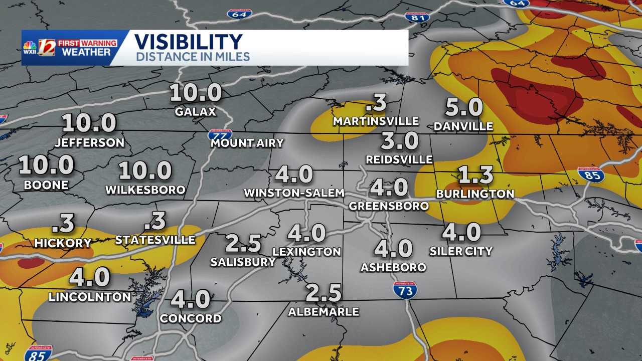
Freezing Fog and Dense Fog Advisory through Sunday morning
Please watch for spotty black ice in the Northern Piedmont and patchy dense fog in areas like Mocksville south toward Charlotte through 10 a.m. on Sunday. National Weather Service (NWS) meteorologists in the Blacksburg, Virginia, and Greer, South Carolina, NWS offices.
Gradual warming Sunday
Temperatures are forecast to drop into the upper 20s, and below freezing temperatures may persist for several hours from Boone to Burlington. We will have a longer period of mostly sunny skies on Sunday than we did on Saturday. Clouds roll in with a developing storm system by late afternoon Sunday. Most of the snow and wintry precipitation may begin after 11 p.m. on Sunday.
Winter weather risk on Monday brings rain and snow chances to North Carolina
The next system may bring snow to the Mountains on Monday morning and rain, flurry or snow mix east in the Foothills and the Piedmont Triad. The temperatures may be too warm for accumulating snow initially east of the Mountains, but we are watching the system carefully to determine whether the moisture and cold air will align to bring hazardous travel.
Current alerts and radar in the Carolinas
Timing
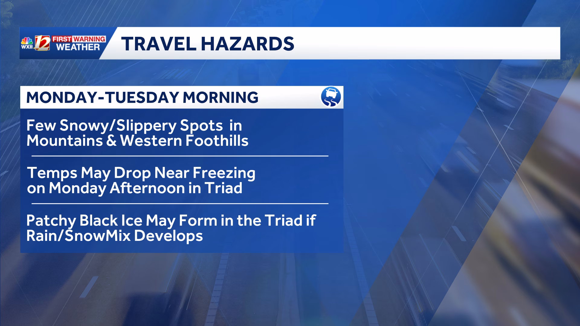
After midnight on Monday through midday Monday is the current forecast timeline for the beginning and ending of the winter weather risk. The extent of icy roads will depend on how much snow falls in the Mountains and Western Foothills.
Forecast confidence level
Our confidence is moderate for mountain snowfall developing early Monday morning. The WXII 12 First Warning Weather team has a lower confidence for overall precipitation falling east of the Blue Ridge Parkway on Monday. The storm system includes the chance of rainfall as moisture and a rain-snow mix for areas along the North Carolina and Virginia state line.
Forecast challenges
- Will it be cold enough in the Piedmont Triad when moisture arrives? Temperatures may persist in the upper 30s until cooling later in the day when precipitation has ended.
- Moisture may simply be too patchy as it moves over the North Carolina Mountains to bring much measurable rainfall or rain and snow mix.
- How much moisture falls and whether surface temperatures are near freezing during the precipitation will determine the extent of black ice or slick travel around the Piedmont Triad.
- Mountain accumulating snowfall is becoming more likely, but there is only moderate confidence in light snowfall accumulating.
Travel Hazards
- Any rain and snow showers that may fall Monday morning may lead to black ice east of the Blue Ridge Parkway, with slippery travel most likely in the Mountains from morning snowfall.
The forecast models have varied greatly in resolving the winter weather forecast for Monday. Once we have higher confidence in the track and timing of the storm that is still developing, we will be able to provide more details on potential impacts to the Triad and Foothills on Monday.
TOP STORIES FROM WXII:
Special edition Stanley tumblers are selling out, but these are still in stock
READ THE FULL STORY:Snow chances return to the North Carolina mountains and a rain/snow mix chance may impact the Triad


Leave a Reply