Experts warn these routes may become disaster hotspots
Across the United States, a handful of transportation corridors are quietly accumulating the ingredients for catastrophe: heavier traffic, more extreme weather, aging infrastructure, and communities with few escape options. Experts who track climate risk, freight flows, and emergency response say these routes are on track to become the next generation of disaster hotspots unless planners change course.
I see the same pattern repeating from coastal interstates to mountain passes and urban freight arteries: roads and rail lines built for a different era are now carrying more people and cargo through landscapes that are hotter, wetter, and more fire prone. The danger is not abstract, it is already visible in flood closures, derailments, and wildfire evacuations that are straining systems never designed for this level of stress.
Coastal highways facing rising seas and stronger storms
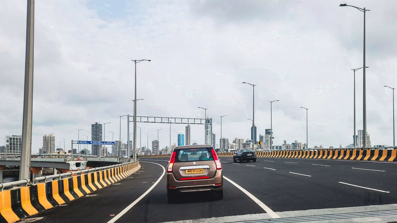
America’s coastal highways are some of its most iconic drives, but they are also among the most exposed to climate risk. Long stretches of asphalt sit just a few feet above sea level, threading through barrier islands, marshes, and low-lying suburbs that are already seeing more frequent tidal flooding and storm surge. When those roads double as evacuation routes, every extra inch of water on the pavement translates into a higher chance that people will be trapped when they most need to move.
Transportation and climate analysts have repeatedly flagged low-elevation corridors along the Gulf Coast and Atlantic seaboard as especially vulnerable, pointing to maps that show key segments intersecting zones of projected sea level rise and intensified hurricanes. In several states, planners are now weighing whether to elevate critical stretches, add new inland bypasses, or accept that some segments will be regularly inundated and must be managed as such. Those choices are being shaped by updated flood modeling and coastal risk assessments that highlight how much of the existing highway network was laid out long before current projections of sea level rise and stronger hurricanes were available.
Rail chokepoints where freight, hazardous cargo, and communities collide
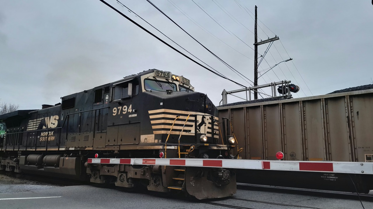
Rail lines that carry hazardous materials through dense neighborhoods are another emerging flashpoint. Many of these routes were established when surrounding land was industrial, not residential, and when freight volumes were lower. Today, longer trains loaded with chemicals, fuels, and other dangerous cargo routinely pass within yards of homes, schools, and small businesses, creating a narrow margin for error if a derailment or fire occurs.
Safety experts have warned that certain junctions and steep grades function as chokepoints where traffic bunches up, inspections are rushed, and any failure can cascade into a multi-car pileup. Investigations into recent derailments have underscored how aging track, deferred maintenance, and limited local hazmat capacity can turn a single mechanical problem into a community-wide emergency. Detailed reporting on hazardous rail traffic and derailment investigations has pushed regulators to revisit routing rules, tank car standards, and the placement of wayside detectors, but many of the highest-risk corridors still run directly through populated areas.
Western wildfire corridors and mountain passes under climate stress
In the American West, the most dangerous routes are often the only ones in or out. Two-lane highways that wind through canyons and over mountain passes now double as lifelines for communities surrounded by forests that are drier and more combustible than in previous decades. When wildfire conditions align with high tourist traffic or commuter peaks, those roads can turn into bottlenecks that trap drivers between advancing flames and limited exits.
Fire behavior specialists and transportation planners have documented how extreme heat, prolonged drought, and dense fuel loads are reshaping the risk profile of these corridors. In several recent fires, evacuation orders had to be staggered or rerouted because primary highways were compromised by smoke, falling debris, or direct flame contact. Analyses of wildfire evacuation routes and mountain pass closures show that many of these roads were engineered for snow and rockfall, not for repeated exposure to high-intensity fire and the landslides that can follow heavy rain on burned slopes.
Urban freight arteries where congestion meets climate risk
Inside major metropolitan areas, the most worrisome routes are often the freight corridors that carry trucks, delivery vans, and buses through flood-prone interchanges and aging viaducts. These roads are essential for keeping grocery shelves stocked and construction sites supplied, yet they are increasingly clogged and exposed to intense downpours that overwhelm drainage systems. When a key interchange floods or a low-lying tunnel fills with water, the disruption ripples across the entire region’s logistics network.
Urban planners and logistics analysts have highlighted specific beltways, river crossings, and warehouse districts where traffic counts are rising even as climate models project more frequent cloudbursts and heat waves. Studies of urban flooded highways and freight corridor congestion point to a convergence of risks: pavement that buckles in extreme heat, storm drains that cannot keep up with short, intense storms, and neighborhoods that already bear disproportionate air pollution from heavy truck traffic. In these places, a single stalled tractor-trailer in standing water can quickly escalate into hours of gridlock, delayed emergency response, and economic losses that extend far beyond the immediate area.
Rural evacuation gaps and the limits of emergency response
Outside the big cities, some of the most precarious routes are the sparse networks that serve rural towns and tribal lands. Here, the problem is not congestion but the lack of redundancy. A single washed-out bridge or landslide can isolate entire communities, cutting off access to hospitals, fuel, and food. When disasters strike, emergency managers must move people and supplies over long distances on roads that may not be paved, lit, or designed for heavy traffic.
Disaster response assessments have repeatedly flagged rural evacuation gaps where residents have few options if the main highway fails. In floodplains, low-lying county roads can disappear under water for days, while in snow and ice storms, remote passes can remain closed long after interstates reopen. Evaluations of rural evacuation plans and infrastructure vulnerability show that limited tax bases and long maintenance backlogs make it difficult for local governments to harden these routes, even as climate projections point to more frequent extremes. The result is a widening gap between the level of risk and the capacity to respond when the road network fails at the moment it is needed most.
More from Fast Lane Only:
- Unboxing the WWII Jeep in a Crate
- The Fastest Farm Truck Ever Built
- 10 Old Trucks That Were Built Like Tanks
- 12 Classic muscle cars still within reach for budget buyers
*Created with AI assistance and editor review.
The post Experts warn these routes may become disaster hotspots appeared first on FAST LANE ONLY.


Leave a Reply